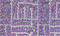
Researchers at the Oak Ridge National Laboratory in Tennessee developed a deep learning-based system that can map every building in the contiguous United States from satellite imagery. The system, which is the first to map the country and the spatial extent between buildings, has the potential to help emergency planning before and after a disaster strikes.
“The generated model output covering the entire U.S. goes through manual quality checks for verification of the model output,” the researchers stated in their research paper. “The impressive results have so far been informative for decision making at scale during Irma and Harvey hurricanes.”
Using NVIDIA Tesla GPUs and the cuDNN-accelerated Caffe deep learning framework, the team trained their system on thousands of multi-spectral images from the National Agriculture Imagery Program (NAIP). It took over 120,000 iterations to train the system, the team said.
For inference, the researchers used eight NVIDIA Tesla GPUs.
“With the preferred model, we processed all NAIP images and established the first building maps covering the contiguous United States with an average processing time less than one minute for an area of size ∼ 56 km2 per each of 8 NVIDIA Tesla GPUs.”
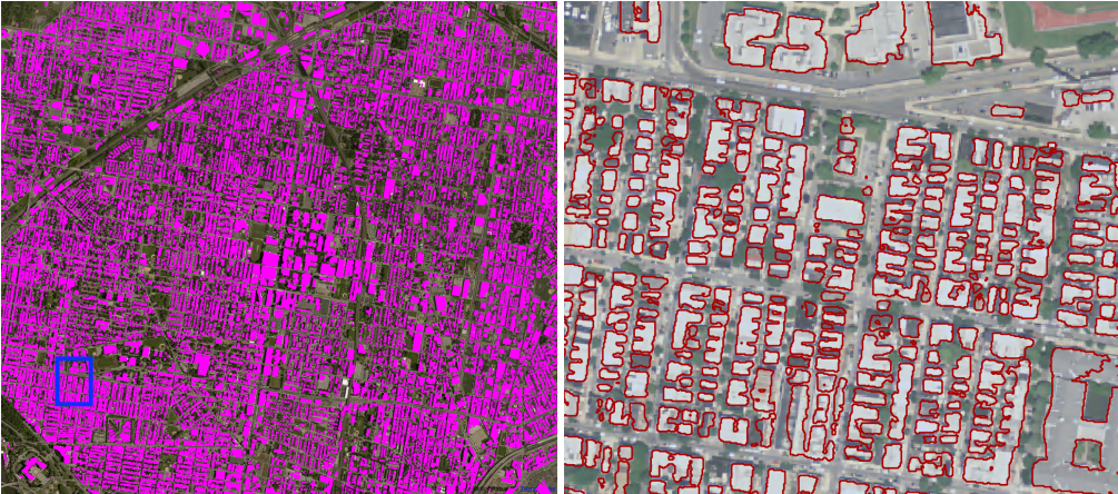
The researchers built their system by combining two previously published studies. Once combined, they added additional layers to determine the space between buildings effectively.
“We propose a simple but effective fusing strategy to combine two CNN models trained with additional spectral bands while still leveraging the learned parameter values of a pre-trained model for initialization,” the researchers said in their research paper. “The fusing approach yields a desirable performance boost. Using a single optimal CNN model derived via the validation process, we generate the first seamless building maps for the contiguous United States with a GPU cluster.”
In future tests, the researchers will investigate the benefits of exploiting newer supercomputers. The Oak Ridge National Laboratory is set to receive one of the world’s most powerful GPU-accelerated supercomputers later this year.
“The exploration of HPC will also enable testing more sophisticated but complicated network architectures. It will potentially benefit building extraction or in general object detection with remote sensing imagery. Currently, the limitations such as the smaller batch size and the size of CNN architectures, are imposed by the capacity of GPU memory and latency between GPU nodes. In addition, with larger GPU memory capacity, we could also investigate the performance of using more than three spectral bands in one CNN for building extraction.”
Read more>
AI-Generated Summary
- Researchers at the Oak Ridge National Laboratory developed a deep learning-based system to map every building in the contiguous United States using satellite imagery, which can aid in emergency planning before and after disasters.
- The system was trained on thousands of multi-spectral images from the National Agriculture Imagery Program using NVIDIA Tesla GPUs and the cuDNN-accelerated Caffe deep learning framework, taking over 120,000 iterations to complete.
- The researchers used a combination of two previously published studies and added additional layers to determine the space between buildings, and they plan to investigate the benefits of using newer supercomputers, including one of the world's most powerful GPU-accelerated supercomputers that the laboratory is set to receive.
AI-generated content may summarize information incompletely. Verify important information. Learn more