Sea levels have traditionally been measured by marks on land – but the problem with this approach is that parts of the earth’s crust move too.
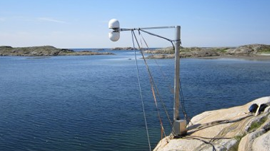
A group of researchers from Chalmers University of Technology in Sweden are using GPS receivers along the coastline in combination with reflections of GPS signals that bounce off the water’s surface. NVIDIA GPUs then crunch those data signals to compute the water level in real-time.
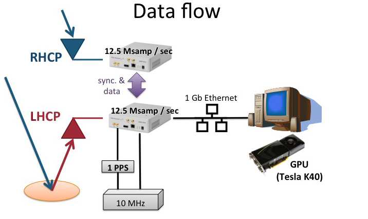
The researchers are using the cuFFT library, alongside NVIDIA Tesla and GeForce GPUs to process the nearly 800 megabits per second of data that come from the reflectometry stream systems.
“Without the use of GPUs, we would not have been able to process all our signals in real-time,” said Thomas Hobiger, a researcher on the project.
This work has placed the team among the top five finalists for NVIDIA’s 2016 Global Impact Award which awards a $150,000 grant to researchers doing groundbreaking work that addresses social, humanitarian and environmental problems.
Read more >>
GPUs Help Measure Rising Sea Levels in Real-Time
Feb 29, 2016
Discuss (0)
AI-Generated Summary
- Researchers from Chalmers University of Technology in Sweden measure sea levels using GPS receivers along the coastline combined with reflections of GPS signals off the water surface.
- NVIDIA Tesla and GeForce GPUs process nearly 800 megabits per second of data from the reflectometry stream systems in real time.
- The team uses the cuFFT library for signal processing on the GPU.
- This work placed the team among the top five finalists for NVIDIA's 2016 Global Impact Award, which provides a $150,000 grant for groundbreaking research addressing social, humanitarian and environmental problems.
Next Steps
- Read the full blog post for more details on the sea-level monitoring research.
Powered by NVIDIA Nemotron. AI-generated content may summarize information incompletely. Verify important information. Learn more
About the Authors