Extreme Event Likelihoods with Guided Generative Models
Across science, engineering, and finance, many of the most important risks come from low-likelihood, high-impact events. Estimating the probability of these...
How to Unlock Local Detail in Coarse Climate Projections with NVIDIA Earth-2
Global climate models are good at the big picture—but local climate extremes, like hurricanes and typhoons, often disappear in the details. Those patterns are...
Gen AI Super-Resolution Accelerates Weather Prediction with Scalable, Low-Compute Models
As AI weather and climate prediction models rapidly gain adoption, the NVIDIA Earth-2 platform provides libraries and tools for accelerating solutions using a...
Predict Extreme Weather Events in Minutes Without a Supercomputer
Scientists from NVIDIA, in collaboration with Lawrence Berkeley National Laboratory (Berkeley Lab), released a machine learning tool called Huge Ensembles...
Less Coding, More Science: Simplify Ocean Modeling on GPUs With OpenACC and Unified Memory
NVIDIA HPC SDK v25.7 delivers a significant leap forward for developers working on high-performance computing (HPC) applications with GPU acceleration. This...
FourCastNet 3 Enables Fast and Accurate Large Ensemble Weather Forecasting with Scalable Geometric ML
FourCastNet3 (FCN3) is the latest AI global weather forecasting system from NVIDIA Earth-2. FCN3 offers an unprecedented combination of probabilistic skill,...
Forecasting the Weather Beyond Two Weeks Using NVIDIA Earth-2
Being able to predict extreme weather events is essential as such conditions become more common and destructive. Subseasonal climate forecasting—predicting...
From Terabytes to Turnkey: AI-Powered Climate Models Go Mainstream
In the race to understand our planet’s changing climate, speed and accuracy are everything. But today’s most widely used climate simulators often struggle:...
How AI Is Shaping Climate Innovation and Sustainable Growth
At GTC 2025, a panel of industry leaders from across the tech ecosystem shared how they’re using AI to mitigate and prepare customers for the increasingly...
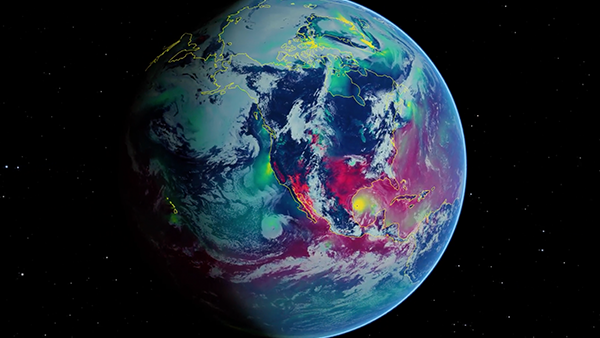
Powering Flood Risk Assessment with NVIDIA Earth-2
Inland flooding causes significant economic and societal impacts annually. Of the eight natural disasters costing the insurance industry over $1 billion in...
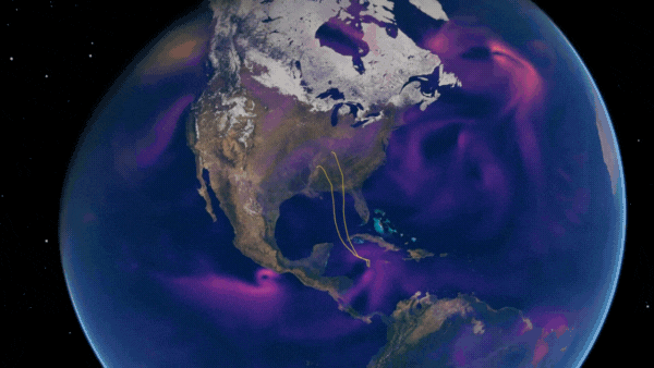
Spotlight: AXA Explores AI-Driven Hurricane Risk Assessment
Large ensembles are essential for predicting rare, high-impact events that cannot be fully understood through historical data alone. By simulating thousands of...
NVIDIA Earth-2 Powers Regional AI Weather Forecasting in the United Arab Emirates
In the United Arab Emirates (UAE), extreme weather events disrupt daily life, delaying flights, endangering transportation, and complicating urban planning....
AI for Climate, Energy, and Ecosystem Resilience at NVIDIA GTC 2025
From mitigating climate change to improving disaster response and environmental monitoring, AI is reshaping how we tackle critical global challenges....
Spotlight: University of Tokyo Uses NVIDIA Grace Hopper for Groundbreaking Energy-Efficient Seismic Research
Supercomputers are the engines of groundbreaking discoveries. From predicting extreme weather to advancing disease research and designing safer, more efficient...
Spotlight: BRLi and Toulouse INP Develop AI-Based Flood Models Using NVIDIA PhysicsNeMo
Flooding poses a significant threat to 1.5 billion people, making it the most common cause of major natural disasters. Floods cause up to $25 billion in global...