GTC Silicon Valley-2019: Mapping Informal Settlements in Developing Countries Using Machine Learning
Note: This video may require joining the NVIDIA Developer Program or login
GTC Silicon Valley-2019 ID:S9362:Mapping Informal Settlements in Developing Countries Using Machine Learning
Benjamin Bischke(German Research Center for Artificial Intelligence (DFKI)),Patrick Helber(German Research Center for Artificial Intelligence (DFKI))
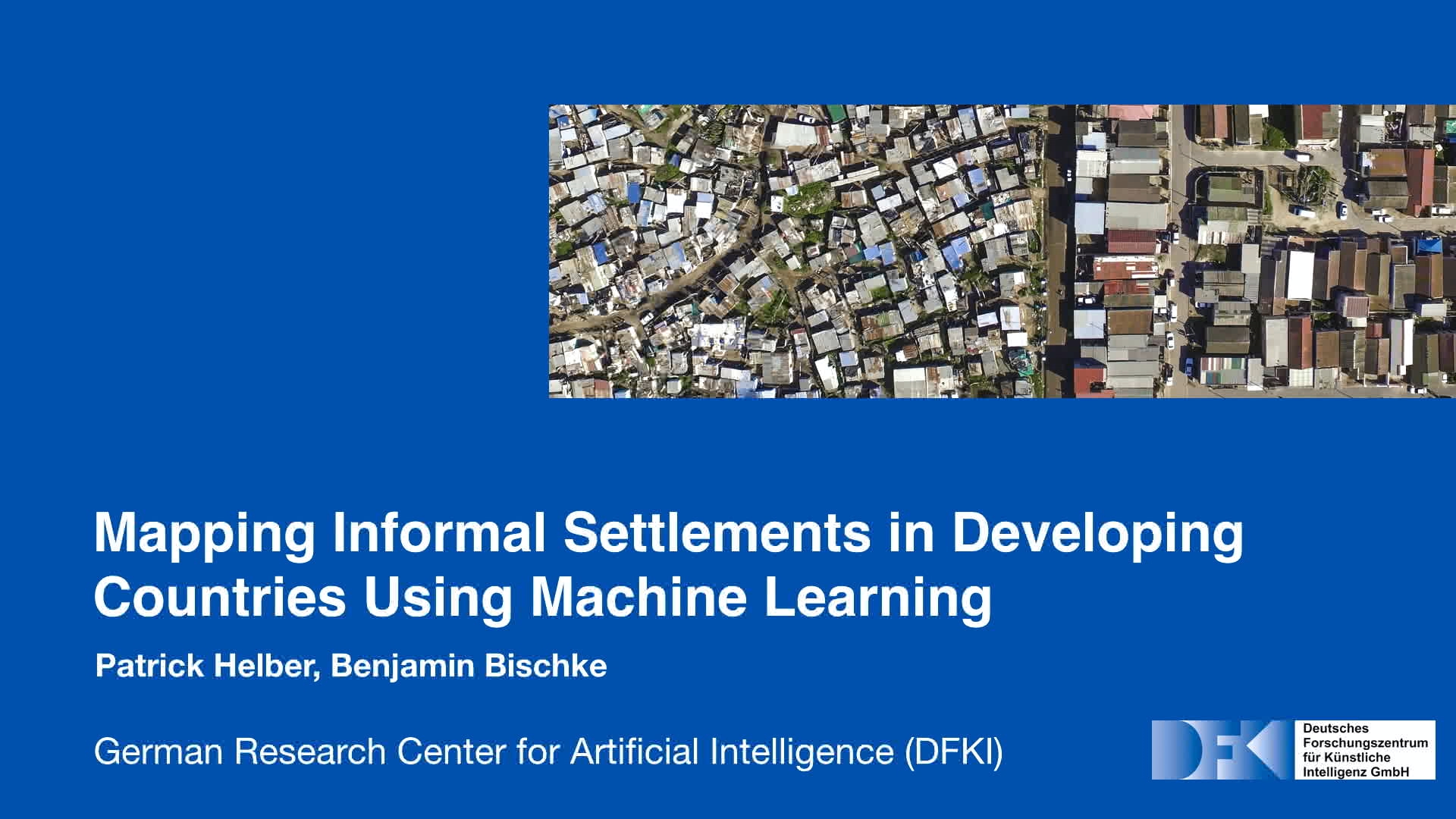
Learn how recent advances in AI can be used to map informal settlements, or slums, in developing countries. We'll show how slums can be mapped using machine learning with noisy annotations and multi-resolution, multi-spectral data. We'll discuss an effective end-to-end framework that detects and maps the locations of informal settlements using low-resolution, freely available Sentinel-2 satellite imagery. Our talk will examine different approaches based on multi-spectral information to identify roofing material types and show how our work can be used for slums all over the world. We'll also describe how multi-spectral, multi-resolution and multi-temporal satellite imagery can be used during natural disasters to quantify the impact on urban infrastructure. This session presents research undertaken in the NASA and ESA Frontier Development Lab.